Why the Philippines is vulnerable
The Philippines lies on a very active section of Earth’s crust — the so-called Pacific “Ring of Fire” — where several tectonic plates converge and interact. As a result, major earthquake zones combine subduction (one plate sliding beneath another), strike-slip faults (plates sliding past each other), and other complex geological features.
Because of this setting, earthquakes of significant magnitude and sometimes destructive impact have occurred repeatedly across the archipelago.

Scan the QR code to get this info on the go.
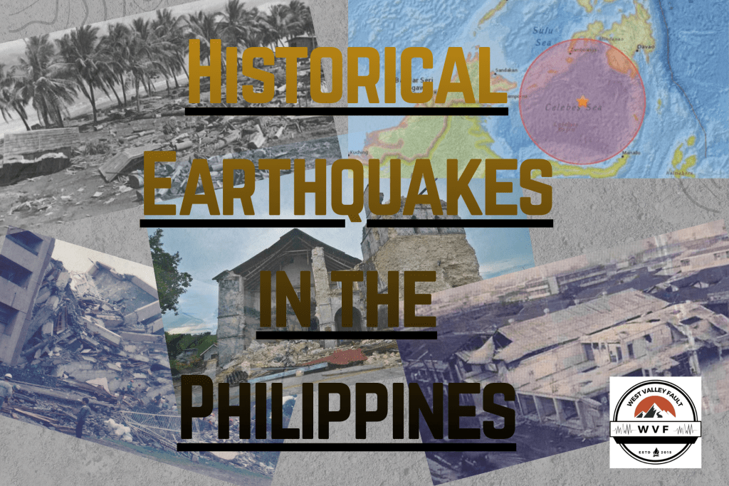
Noteworthy Earthquakes in Philippine History
Here are some of the most impactful seismic events in Philippine history:
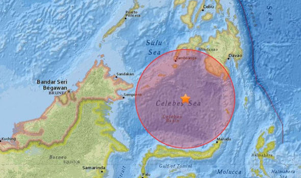
1. 1918 Celebes Sea earthquake (August 15, 1918)
Key facts:
- Magnitude about 8.3 (moment magnitude scale) near the Celebes Sea, just off the southern coast of Mindanao.
- Triggered a significant tsunami (run‐up up to ~7 m) along the southwestern coast of Mindanao, especially around Sarangani Bay.
- Casualties recorded at ~52 confirmed, though some sources suggest higher.
- All houses destroyed along parts of the coast in southwestern Mindanao; major landslides were recorded.
Famous landmark:
Fortunately, there is no widely cited specific landmark (such as a famous church or monument) referenced in relation to this event.
Why it matters:
- This remains among the strongest earthquakes recorded in the Philippines.
- It set a precedent for understanding tsunami hazard in this region.
2. 1968 Casiguran earthquake (August 2, 1968)


Key facts:
- Magnitude about 7.6 (thrust fault), epicenter near Casiguran (Aurora Province).
- Generated a relatively small tsunami (~0.3 m) but caused major damage in Manila due to building collapse.
- At least 207–271 people killed, many of them in the collapse of a six‐story residential/commercial building in Manila.
Famous landmark:
- Ruby Tower in Manila — a six‐storey building in Binondo (corner Doroteo Jose & Teodora Alonzo streets) which collapsed during this quake.
Why it matters:
- Highlights how an earthquake with moderate magnitude can still cause grave urban damage when buildings are vulnerable.
- The Ruby Tower collapse became a reference point for building codes and structural safety in the Philippines.
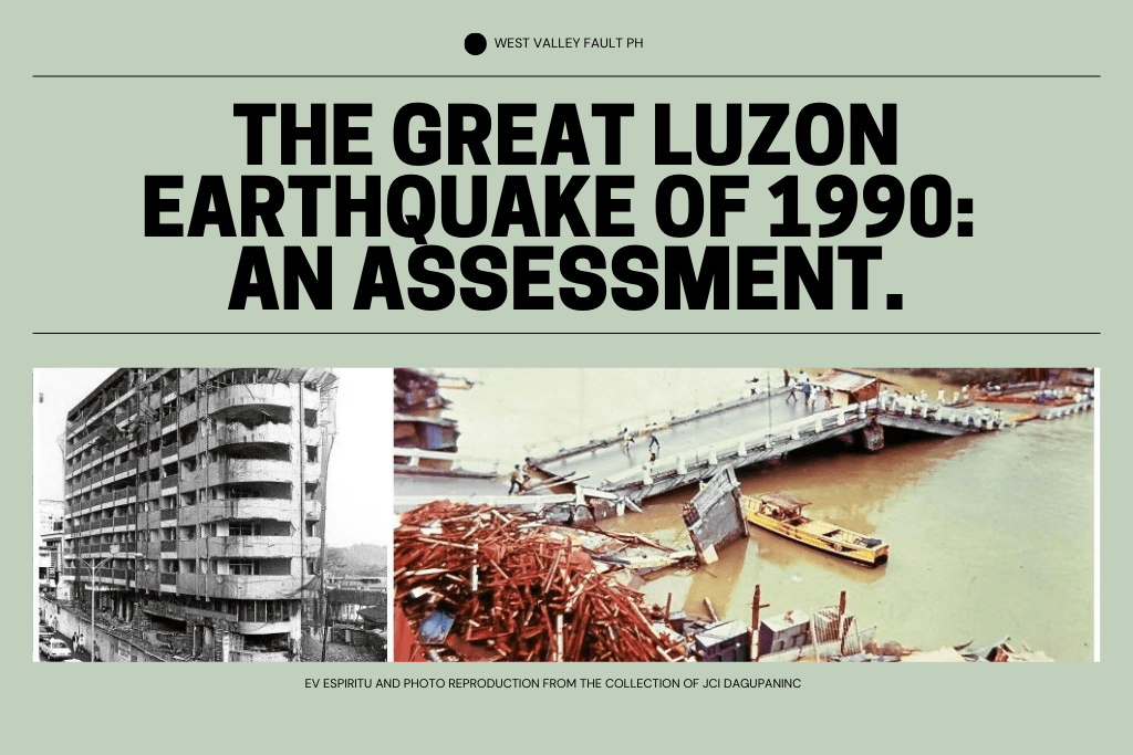
See what they found out about the Great Luzon Earthquake of 1990
3. 1976 Moro Gulf earthquake & tsunami (August 16–17, 1976)
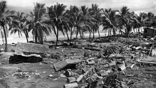
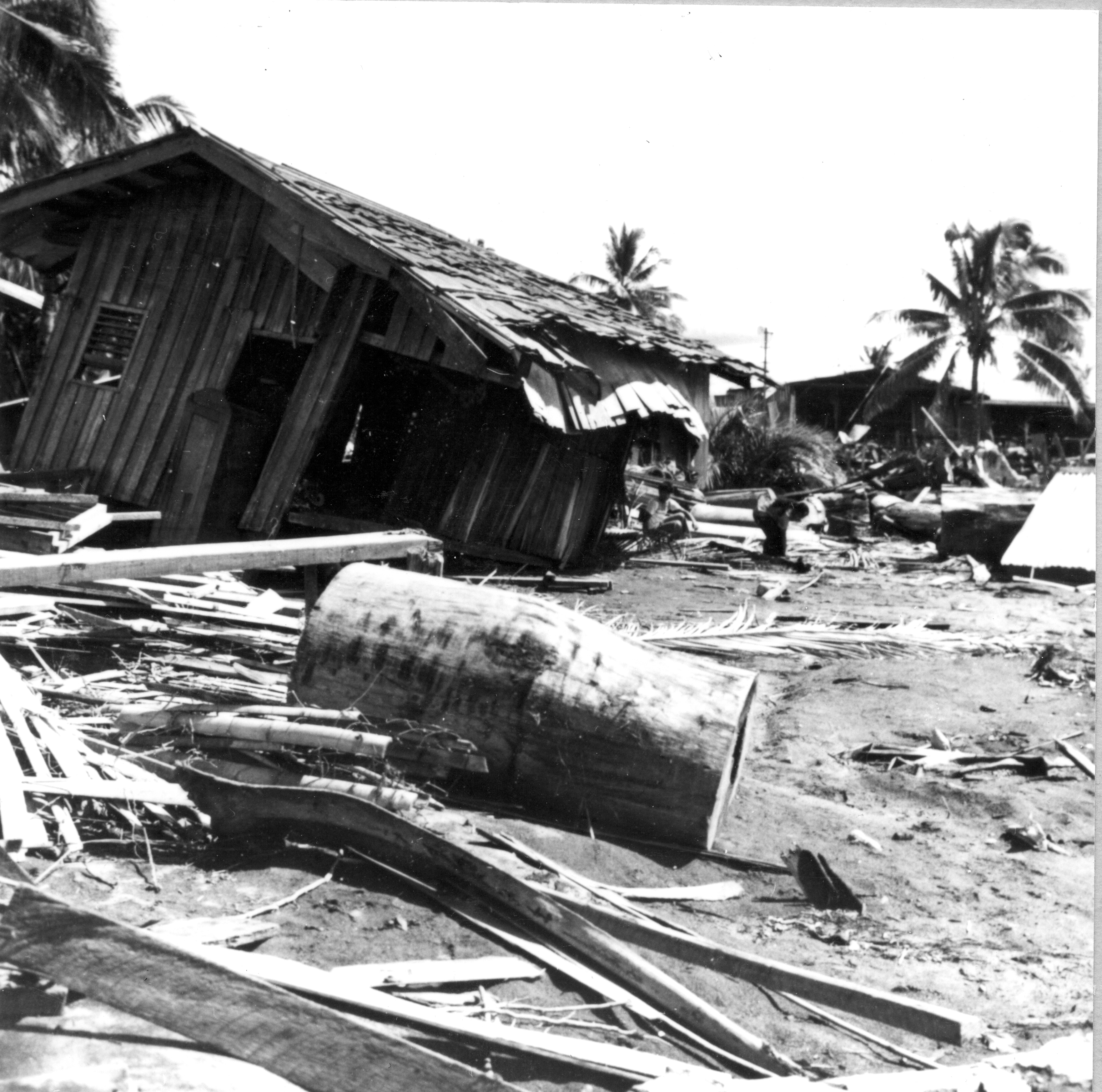


Key facts:
- Magnitude around 8.0, epicenter in the Moro Gulf region (southern Philippines).
- Accompanied by a destructive tsunami, estimated fatalities between 5,000 and 8,000.
- Vast homelessness (tens of thousands), widespread destruction of coastal communities.
Famous landmark:
- While specific “well‐known” architectural landmarks are less documented in this event (compared to earthquakes in tourist or urban centres), the coastal communities along the Moro Gulf themselves became reference points for vulnerability.
Why it matters:
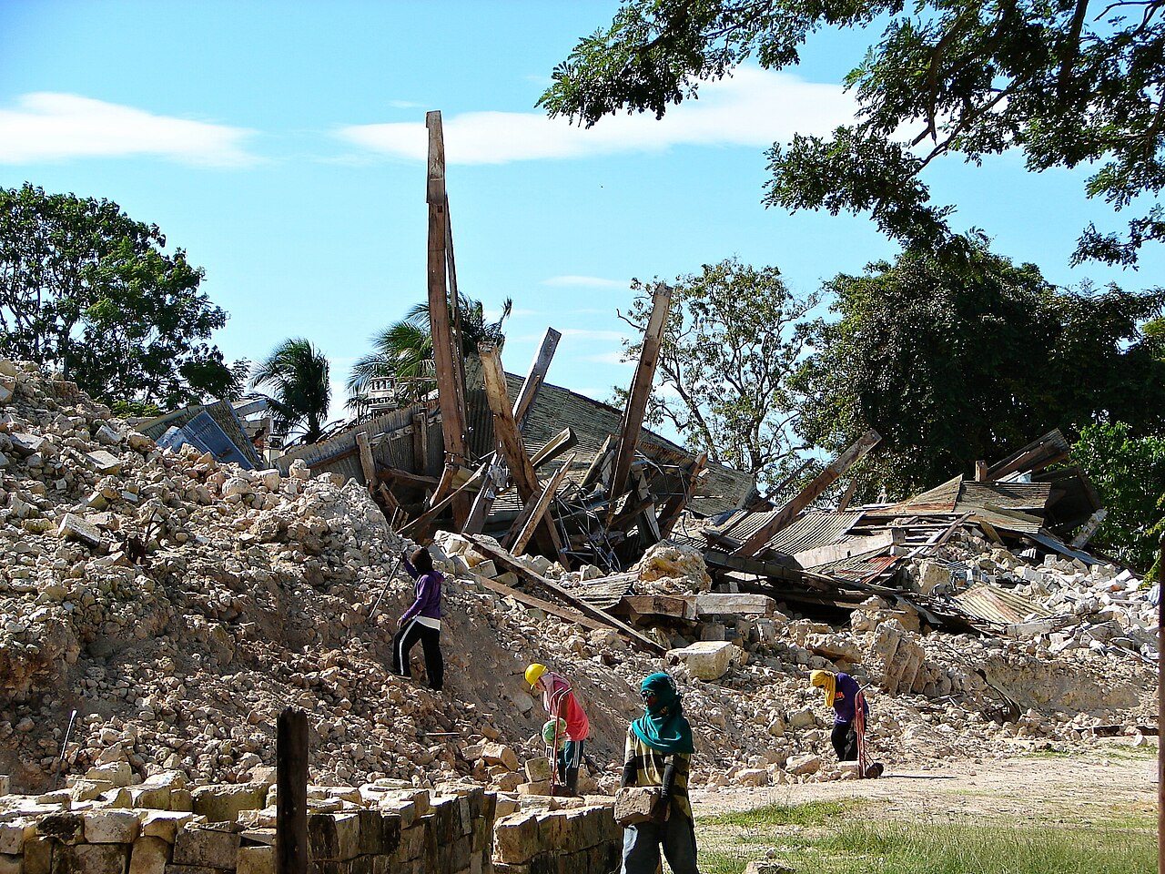
- Still considered the deadliest earthquake‐tsunami event in the Philippines in the 20th century.
- Demonstrates high tsunami risk in the southern Philippines.
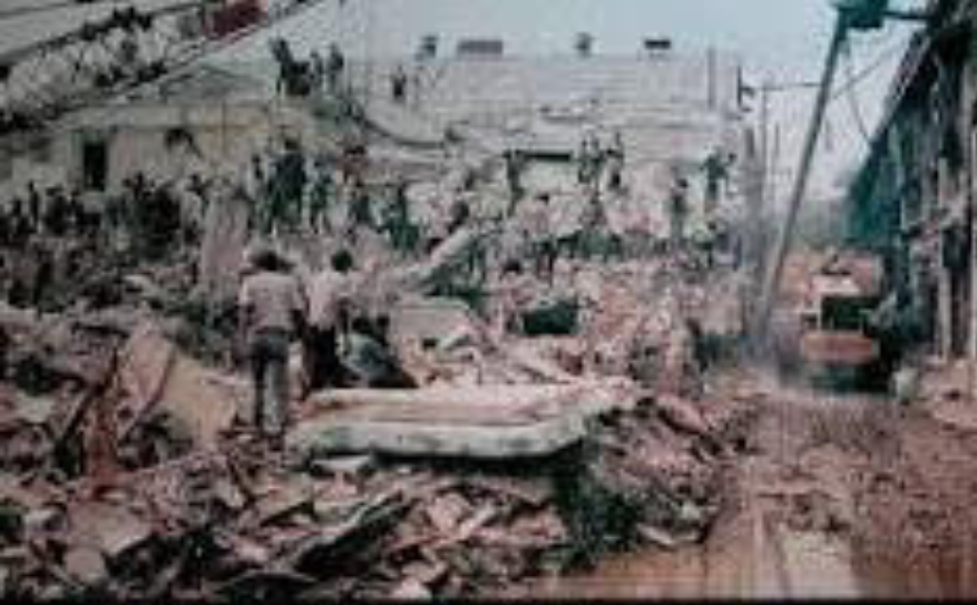
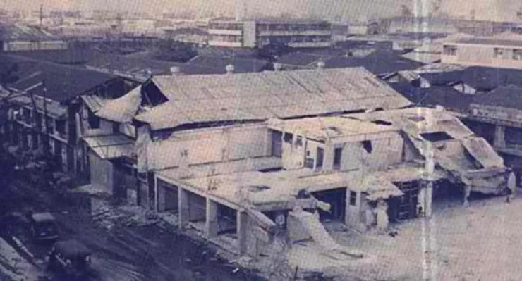
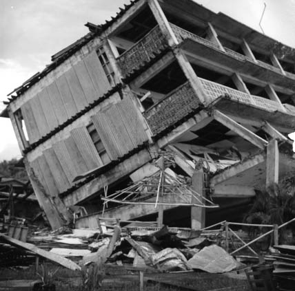
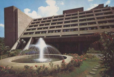
4. 1990 Luzon earthquake (July 16, 1990)


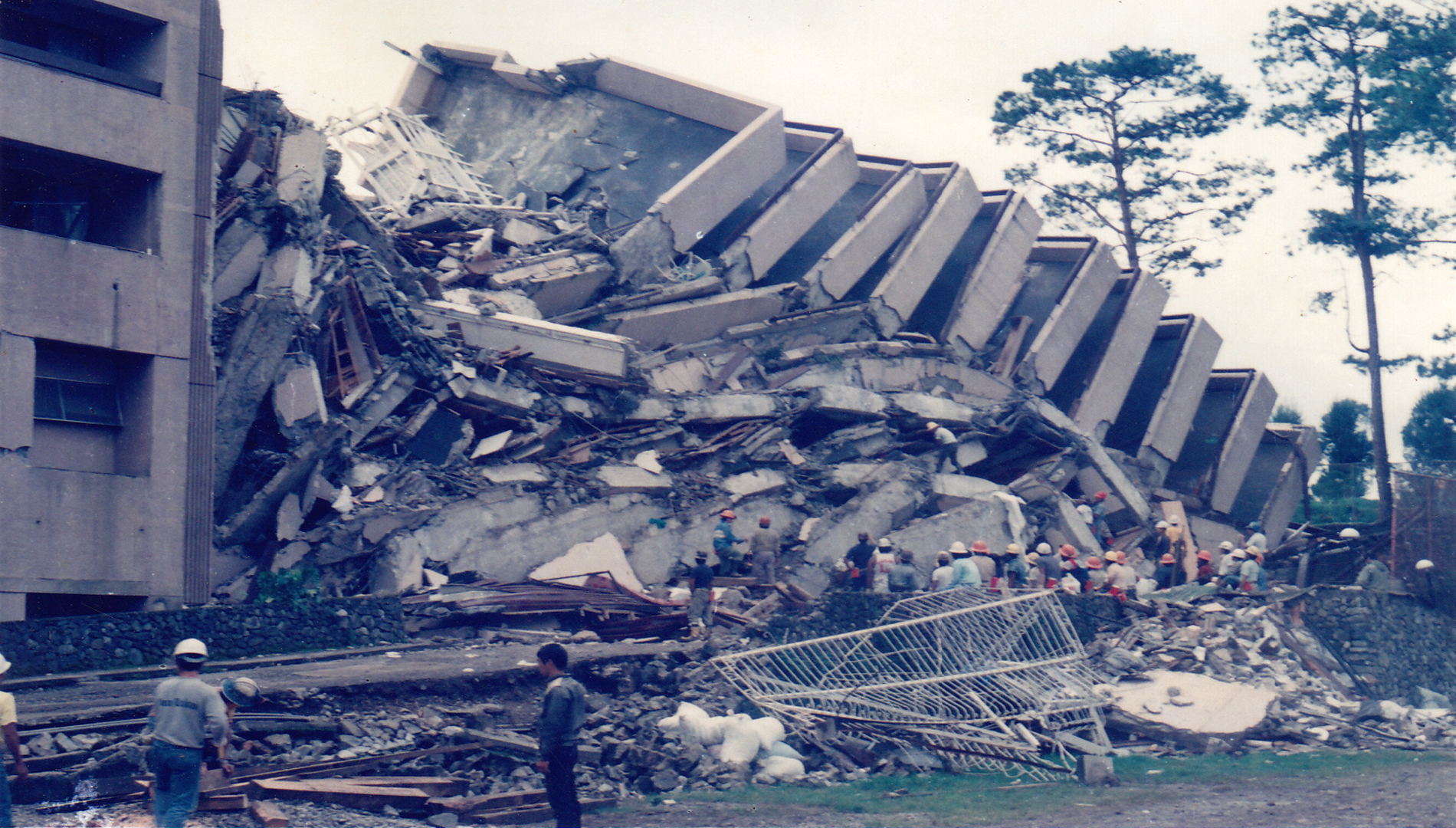
Key facts:
- Magnitude ~7.8 ; epicenter in Rizal, Nueva Ecija with rupture length ~125 km stretching from Dingalan (Aurora) to Kayapa (Nueva Vizcaya).
- At least 1,600+ fatalities; many injuries and displacement across Luzon.
Famous landmark:
- In the city of Baguio (a major tourist centre), several hotel buildings collapsed — notably the Hyatt Terraces Hotel among them.
Why it matters:
- This event is a reminder that even in mountainous, tourist‐heavy zones, vulnerable structures and terrain (landslides, ruptures) increase risk.
5. 2013 Bohol earthquake (October 15, 2013)

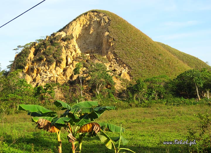
Key facts:
- Magnitude ~7.2; epicentre near Carmen, Bohol.
- More than 200 fatalities, tens of thousands of houses damaged or destroyed, and many built heritage structures collapsed.
Famous landmarks:
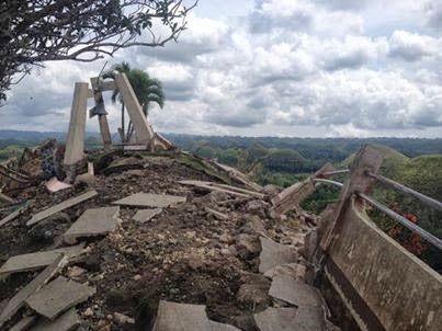
- The Chocolate Hills in Carmen, Bohol — the viewing deck was severely damaged, and some hills experienced landslides.
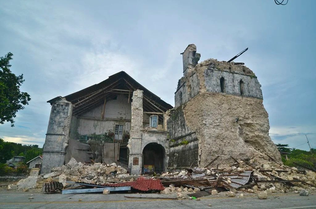
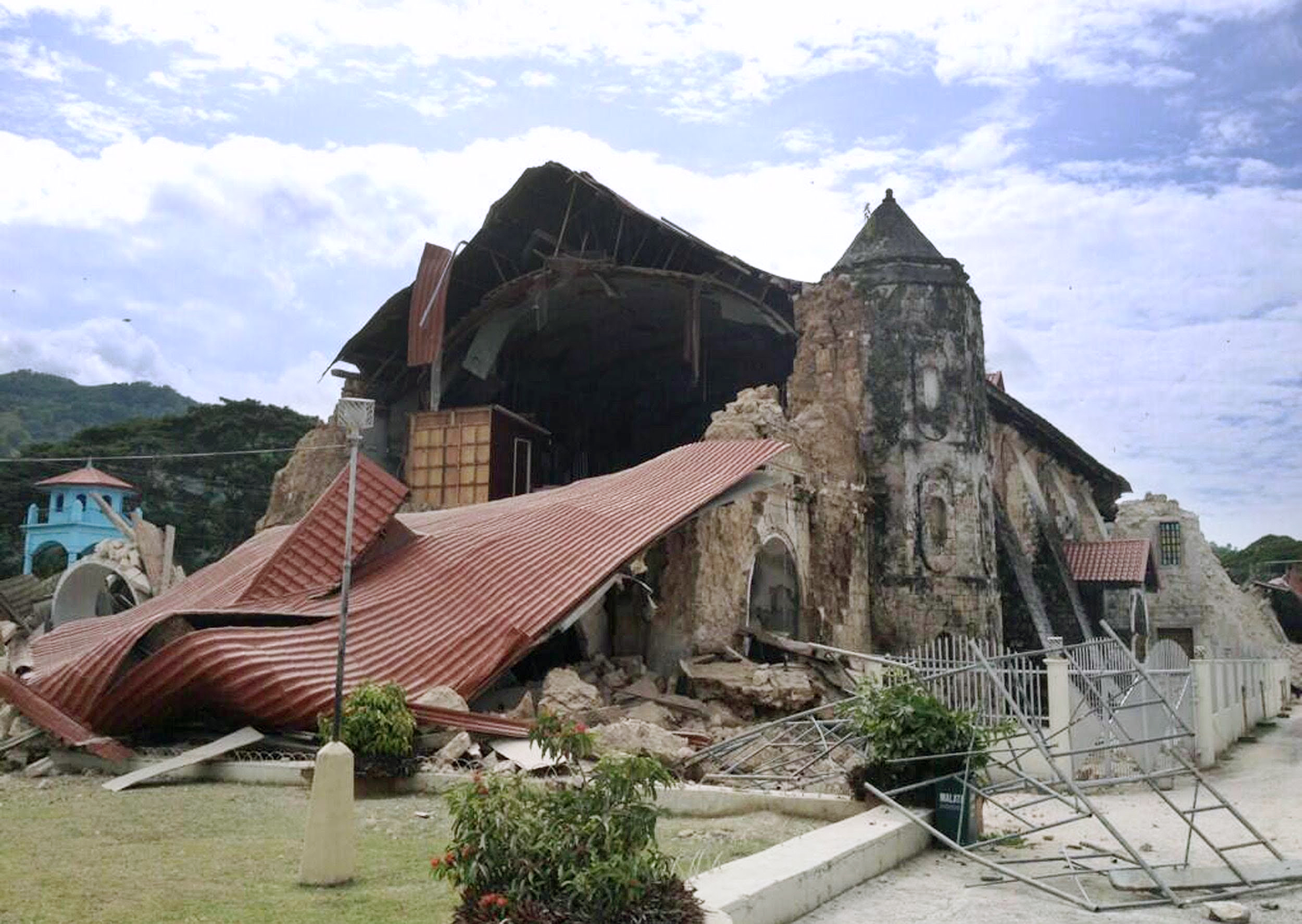
- The Loon Church (Our Lady of Light Parish) — declared a National Cultural Treasure; it was destroyed in the quake.
Why it matters:
- Shows how earthquakes can impact not only lives and infrastructure but also cultural heritage and tourism.
- Underlines that relatively lower magnitude quakes (compared to e.g. 8.0 events) can still be devastating depending on local conditions.
Historical Earthquakes in the Philippines Infographic

Why We Should Care
For residents, business owners, government agencies and visitors — understanding this seismic history is key. It guides land use planning, building codes, insurance schemes, emergency response, and individual preparedness. A large quake can affect lives, livelihoods, infrastructure and long‐term development.

Final Thoughts
While we cannot predict exactly when or where the next major earthquake will strike in the Philippines, history shows that major events will occur. By learning from past quakes, strengthening resilience, and staying aware, communities can reduce risk and improve responses. If you live or work in the Philippines (or visit frequently), taking simple steps such as knowing safe places in your home or workplace, having an emergency kit, and staying informed can make a significant difference.
Sources:
“List: Killer earthquakes in the Philippines” Inquirer.net
“List of earthquakes in the Philippines” Wikipedia+1
“Destructive Earthquakes in the Philippines” phivolcs.dost.gov.ph+1
“Most Severe Earthquakes in the Philippines” PhilAtlas+1
“Historical Earthquake – PHIVOLCS” www2.phivolcs.dost.gov.ph


Leave a comment