Executive Summary
When discussions about The Big One arise, one question consistently dominates public concern: Which cities are likely to be affected the most?
The answer is more complex than simply identifying communities located along the West Valley Fault. While cities directly traversed by the fault face the possibility of intense ground shaking and localized surface rupture, earthquake risk is also influenced by many other factors. Population density, building vulnerability, soil conditions, liquefaction susceptibility, critical infrastructure, and urban development all play significant roles in determining how severely a city could be impacted.
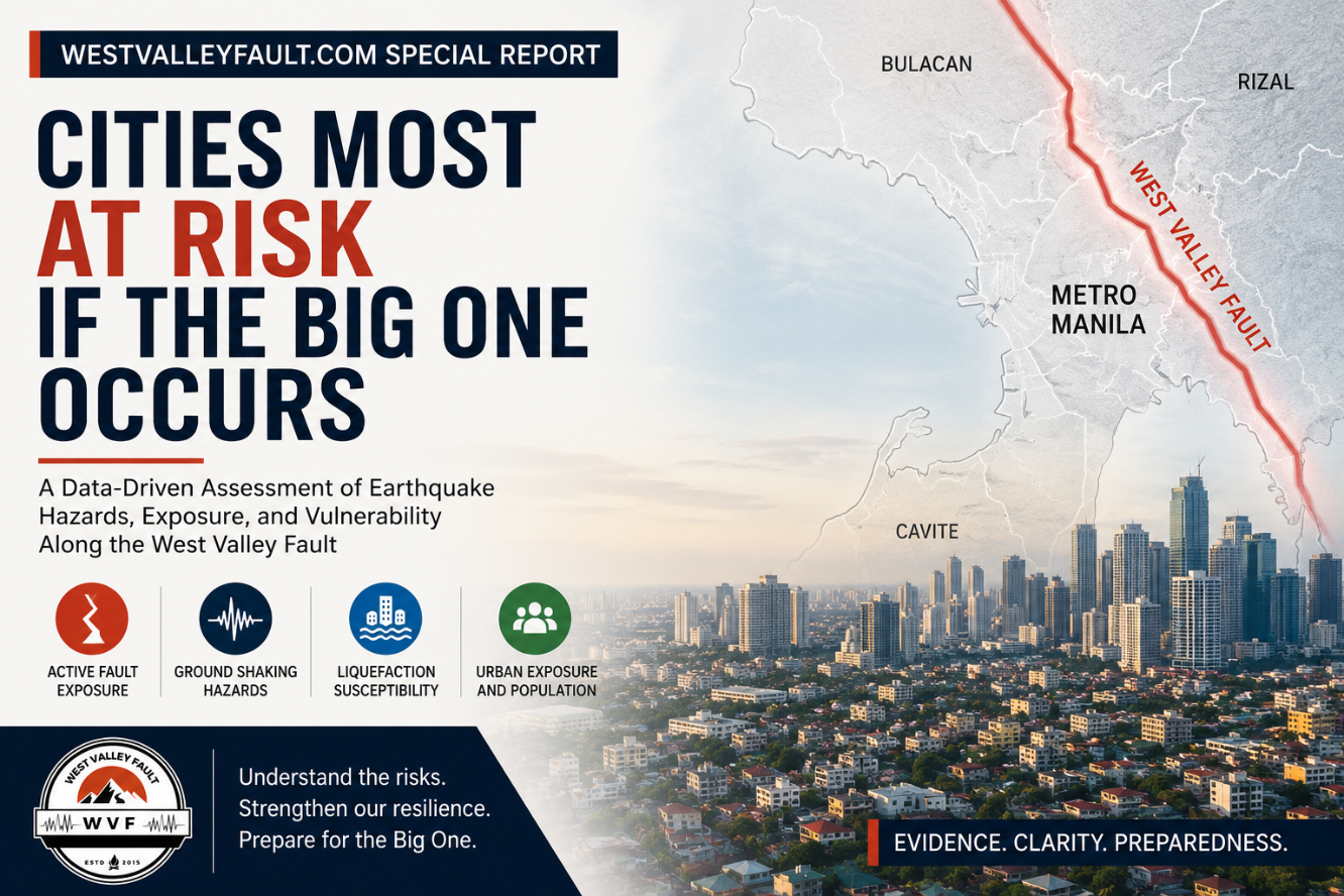
This Special Report examines the latest scientific information from PHIVOLCS, the Metro Manila Earthquake Impact Reduction Study (MMEIRS), and other authoritative sources to identify the factors that contribute to earthquake risk across Metro Manila and neighboring provinces. Rather than producing an arbitrary ranking, the report compares cities using transparent, evidence-based indicators that explain why some areas may face greater challenges than others during a magnitude 7.2 earthquake along the West Valley Fault.
By understanding these differences, residents, businesses, and local governments can make more informed decisions about preparedness, mitigation, and resilience. The objective is not to create fear or declare any city “unsafe,” but to provide a clearer understanding of where the greatest hazards exist, what those hazards are, and how preparedness can significantly reduce their impact when The Big One eventually occurs.
Before you read further — do you know your property’s actual risk? Use WVF’s step-by-step PHIVOLCS property hazard check to identify the nearest mapped active fault and review the wider hazard picture for a specific location.
Free Earthquake Risk Checklist

Check the key earthquake hazards that may affect a specific property — including proximity to active faults, liquefaction exposure, and important building-safety considerations.
Enter your email below and we’ll send you the free checklist, together with WVF preparedness updates.
Small disclaimer: This checklist is an educational screening tool—not an official hazard assessment or guarantee of safety.
Chapter 1
Understanding Earthquake Risk: Why Some Cities Face Greater Danger Than Others

When discussions about The Big One arise, one of the first questions people ask is deceptively simple:
Which cities will be hit the hardest?
It is a reasonable question, but it does not have a simple answer.
Many assume that the cities at greatest risk are those located directly above the West Valley Fault. While proximity to the fault is one of the most important factors, it is only one part of a much larger picture. Earthquake disasters are shaped by a combination of geological hazards, urban development, population exposure, and the resilience of the built environment.
A city located several kilometers away from the fault may still experience severe damage if it contains soft sediments that amplify seismic waves, extensive areas susceptible to liquefaction, aging infrastructure, or a high concentration of vulnerable buildings. Conversely, a community closer to the fault but built with modern, earthquake-resistant structures and effective preparedness measures may experience significantly fewer losses than expected.
For this reason, earthquake scientists distinguish between hazard and risk.
An earthquake hazard refers to the natural processes generated by an earthquake itself, such as surface fault rupture, strong ground shaking, liquefaction, landslides, or tsunami where applicable. These hazards are determined primarily by geology and cannot be prevented.
Risk, however, is the potential for those hazards to cause harm. It depends on what lies in the path of the hazard: the number of people exposed, the vulnerability of buildings and infrastructure, and the ability of communities to withstand and recover from the event. Two cities subjected to similar levels of ground shaking may experience very different outcomes because their levels of exposure and resilience differ.
This distinction is particularly important in Metro Manila and neighboring provinces. The metropolitan region contains some of the country’s highest concentrations of population, economic activity, transportation networks, hospitals, schools, and government facilities. A major earthquake along the West Valley Fault would therefore affect not only communities located near the fault trace but also cities whose importance as residential, commercial, or transportation hubs makes them especially vulnerable to widespread disruption.
This Special Report does not attempt to produce an arbitrary ranking of the “most dangerous” cities. Instead, it examines the scientific evidence used by earthquake experts to assess urban earthquake risk. Drawing upon studies by the Philippine Institute of Volcanology and Seismology (PHIVOLCS), the Metro Manila Earthquake Impact Reduction Study (MMEIRS), and other authoritative sources, the report compares the factors that increase vulnerability across major cities in and around Metro Manila.
Throughout the following chapters, readers will see that earthquake risk cannot be explained by a single map or a single measurement. Surface fault rupture expected ground shaking, liquefaction susceptibility, population density, critical infrastructure, and building vulnerability all contribute to the overall picture. Understanding these factors individually—and how they interact—provides a far more accurate assessment than any simple list or ranking ever could.
The goal is straightforward: to replace assumptions with evidence, helping readers understand not only which cities may face greater challenges during The Big One, but why.
Want to understand the earthquake scenario behind this report? Read our flagship guide, The Big One Philippines: What Experts Say About the Next Metro Manila Earthquake, where we explain what experts expect from a magnitude 7.2 earthquake on the West Valley Fault, why it matters, and how it could affect millions of residents across Metro Manila and nearby provinces.
Key Takeaways
- Earthquake hazard and earthquake risk are not the same.
- Proximity to the West Valley Fault is only one factor influencing a city’s overall vulnerability.
- Ground shaking, liquefaction, population exposure, infrastructure, and building resilience all contribute to earthquake risk.
- This report compares cities using transparent, evidence-based indicators rather than subjective rankings.
- The objective is to improve understanding and preparedness through scientific evidence, not to create fear or sensationalize risk.
Chapter 2
Cities Traversed by the West Valley Fault

For many Filipinos, the phrase “The Big One” is almost synonymous with the West Valley Fault. It is the country’s most closely monitored active fault because of its ability to generate a magnitude 7.2 earthquake and because it passes through one of the most densely populated urban regions in Southeast Asia.
One of the most common misconceptions is that only cities directly crossed by the fault are at risk. In reality, these cities face a unique hazard—the possibility of surface fault rupture—but they are not the only communities expected to experience severe impacts. Cities located outside the fault trace may still experience violent ground shaking, liquefaction, infrastructure damage, and widespread disruption. Those hazards will be examined in later chapters.
Understanding which cities are traversed by the West Valley Fault is nevertheless an essential starting point because surface rupture is one of the few earthquake hazards that cannot be engineered away. Buildings, roads, pipelines, bridges, and utilities constructed directly across an active fault may be displaced by several meters during a major earthquake, making avoidance the primary mitigation strategy.
What Is Surface Fault Rupture?
During a major earthquake, accumulated tectonic stress is suddenly released as the two sides of a fault move relative to each other. When that movement reaches the ground surface, it produces what geologists call surface fault rupture.
Unlike ground shaking, which affects broad areas, surface rupture is highly localized. However, within the rupture zone, the damage can be catastrophic. Buildings that straddle the fault may experience severe structural failure regardless of how well they were designed, while roads, bridges, pipelines, and utility corridors crossing the fault can be permanently displaced.
For this reason, PHIVOLCS identifies an Active Fault Zone extending several meters on either side of the mapped fault trace where permanent structures should not be constructed. Local government land-use planning and engineering regulations are intended to recognize these hazard zones during development.
Cities Traversed by the West Valley Fault
According to official PHIVOLCS active fault maps, the West Valley Fault passes through portions of the following cities and municipalities:
Metro Manila
- Quezon City
- Marikina
- Pasig
- Makati
- Taguig
- Muntinlupa
Rizal Province
- San Mateo
- Rodriguez (Montalban)
Laguna Province
- Biñan
- Santa Rosa
Cavite Province
- Carmona
These local government units contain segments of the mapped fault trace. It is important to emphasize that this does not mean the entire city lies on the fault. In most cases, only specific barangays or portions of a city intersect the active fault, while large areas remain well away from the mapped rupture zone.
Living in a Fault-Traversed City
Living in one of these cities should not be interpreted as a prediction of inevitable disaster.
Modern earthquake engineering, responsible land-use planning, and strict compliance with building codes can substantially reduce earthquake losses from ground shaking. However, structures located directly across the active fault itself face a different challenge. Because the ground on either side of the fault may shift horizontally and vertically during a major earthquake, no conventional building can be designed to safely withstand permanent ground displacement occurring directly beneath its foundation. This is why avoiding construction across active fault traces remains the internationally accepted approach to reducing surface rupture risk.
For residents, the most practical step is understanding whether their home, workplace, school, or business is located near the mapped fault trace. PHIVOLCS provides official active fault maps that allow communities and property owners to identify whether a property lies within or near an active fault zone. That knowledge can help guide future construction, redevelopment, and preparedness planning.
Free Earthquake Risk Checklist

Free Earthquake Risk Checklist
Check the key earthquake hazards that may affect a specific property — including proximity to active faults, liquefaction exposure, and important building-safety considerations.
Enter your email below and we’ll send you the free checklist, together with WVF preparedness updates. Unsubscribe anytime.
Small disclaimer: This checklist is an educational screening tool—not an official hazard assessment or guarantee of safety.
Surface Rupture Is Only One Part of the Story
Although cities crossed by the West Valley Fault receive much of the public’s attention, they do not automatically represent the areas expected to suffer the greatest overall impacts.
Some cities located farther from the fault may experience equally severe—or in certain circumstances even greater—damage because of soil amplification, liquefaction, high population density, aging infrastructure, or the concentration of critical facilities.
These factors explain why scientists evaluate earthquake risk using multiple indicators rather than distance from the fault alone. The next chapter examines one of the most significant of these: ground shaking intensity, which can extend far beyond the fault itself.
Living near an active fault is only one part of the earthquake risk equation. If you’re evaluating a specific property, our guide Is Your Home Fault-Line Ready? walks you through practical checks every homeowner should perform before buying, building, or renovating.
Key Takeaways
- The West Valley Fault traverses portions of several cities and municipalities across Metro Manila, Rizal, Laguna, and Cavite.
- Cities crossed by the fault face the unique hazard of surface fault rupture, where the ground itself may permanently shift during a major earthquake.
- Only specific portions of these cities intersect the mapped fault trace; the entire city is not located on the fault.
- Surface rupture is distinct from ground shaking and cannot be mitigated solely through stronger building design.
- Being crossed by the fault is only one component of earthquake risk. Other hazards—including strong ground shaking and liquefaction—may significantly affect cities beyond the fault corridor.
Chapter 3
Beyond the Fault: Cities Expected to Experience the Strongest Ground Shaking

When people hear that the West Valley Fault passes through only a handful of cities, many assume communities farther away have little to worry about.
That assumption is incorrect.
One of the most widespread and destructive hazards during a major earthquake is strong ground shaking, and unlike surface fault rupture, it is not confined to the immediate vicinity of the fault. Seismic waves radiate outward from the earthquake source, affecting communities across Metro Manila and neighboring provinces. In many cases, cities located several kilometers away from the fault may still experience shaking intense enough to damage buildings, disrupt infrastructure, and threaten lives.
For this reason, earthquake scientists distinguish between proximity to the fault and expected shaking intensity. While these factors are related, they are not identical. A city may not be directly crossed by the West Valley Fault yet still experience destructive shaking because of its distance from the rupture, local geology, and underlying soil conditions.
How Ground Shaking Is Measured
Ground shaking is commonly described using intensity, which reflects how strongly an earthquake is felt and the degree of damage it can cause at a particular location. Unlike magnitude, which measures the energy released at the earthquake source, intensity varies from place to place.
Several factors influence shaking intensity, including:
- Distance from the earthquake source
- Depth of the earthquake
- Local soil and rock conditions
- Duration of shaking
- Building characteristics
As a result, two cities located similar distances from the fault may experience different levels of shaking depending on the ground beneath them and the types of structures present.
What the Metro Manila Earthquake Impact Reduction Study Shows
One of the most comprehensive assessments of a magnitude 7.2 earthquake on the West Valley Fault is the Metro Manila Earthquake Impact Reduction Study (MMEIRS), conducted through collaboration between Philippine government agencies and the Japan International Cooperation Agency (JICA).
The study concludes that a major rupture of the West Valley Fault would generate very strong to destructive ground shaking across much of Metro Manila, extending well beyond the cities directly traversed by the fault. The effects would not stop at administrative boundaries. Instead, shaking would spread throughout the metropolitan area, affecting residential communities, commercial districts, transportation networks, and critical infrastructure.
This finding reinforces an important point: being outside the mapped fault trace does not mean being outside the danger zone.
Cities Expected to Experience Severe Ground Shaking
Based on the fault’s location and the regional hazard assessments, cities expected to experience particularly strong ground shaking include those both on and near the West Valley Fault, as well as highly urbanized districts across Metro Manila.
These include:
- Quezon City
- Marikina
- Pasig
- Makati
- Taguig
- Muntinlupa
- Manila
- Mandaluyong
- San Juan
- Pasay
- Parañaque
- Las Piñas
- Caloocan
The intensity experienced within each city will not be uniform. Conditions can vary considerably between neighborhoods due to differences in geology, elevation, and land reclamation. Residents living only a few kilometers apart may experience noticeably different levels of shaking.
City-level findings are only a starting point.
Earthquake exposure can differ between neighborhoods—and even between properties—because of active-fault proximity, ground conditions, building quality and access to emergency services. Use the free Home Buyer’s Earthquake Risk Guide to investigate the location that matters to your family.
Why Soft Ground Matters
Not all ground responds to earthquakes in the same way.
Areas underlain by hard bedrock generally transmit seismic waves differently from areas composed of soft sediments, reclaimed land, or unconsolidated river deposits. Soft soils can amplify earthquake motions, increasing the duration and intensity of shaking experienced at the surface.
This phenomenon helps explain why some districts sustain disproportionately greater damage even when they are located farther from the fault than neighboring communities.
For engineers and urban planners, understanding local soil conditions is therefore just as important as knowing the location of the fault itself.
Strong Shaking Does Not Mean Uniform Damage
Even within areas expected to experience similar shaking intensities, the consequences can differ dramatically.
Modern buildings designed and constructed in accordance with current seismic codes generally perform much better than older or poorly maintained structures. Building design, construction quality, maintenance, occupancy, and compliance with engineering standards all influence how a city ultimately fares during a major earthquake.
In other words, ground shaking creates the hazard, but building performance largely determines the disaster.
This distinction explains why earthquake preparedness extends beyond geological maps. Investments in resilient infrastructure, updated building standards, retrofitting, and public preparedness can substantially reduce casualties and economic losses, even in cities expected to experience severe shaking.
Looking Beyond Ground Shaking
Although strong ground shaking is likely to affect much of Metro Manila, it is only one of several hazards associated with a major earthquake.
Some areas face an additional threat that receives far less public attention but can dramatically increase damage: liquefaction. In these locations, the ground itself may temporarily lose its strength, causing buildings, roads, and underground utilities to settle or tilt even if they are not located directly on the fault.
The next chapter examines where liquefaction is most likely to occur and why this often-overlooked hazard deserves equal attention in earthquake preparedness planning.
Key Takeaways
- Strong ground shaking extends far beyond the West Valley Fault itself.
- Earthquake intensity varies by location and is influenced by distance, geology, and soil conditions.
- MMEIRS indicates that much of Metro Manila could experience destructive shaking during a magnitude 7.2 West Valley Fault earthquake.
- Soft sediments and reclaimed land can amplify seismic waves, increasing earthquake impacts.
- The severity of damage depends not only on shaking but also on building quality, engineering standards, and preparedness.
Chapter 4
Liquefaction: The Hidden Hazard Beneath Some Philippine Cities

When most people imagine the effects of The Big One, they picture violent ground shaking or a visible crack splitting the earth along the West Valley Fault.
But another hazard could cause equally devastating damage in certain parts of Metro Manila and neighboring provinces—liquefaction.
Unlike surface fault rupture, liquefaction occurs beneath the ground and can affect areas located far from the fault itself. During a major earthquake, water-saturated, loose sandy soils may temporarily lose their strength and behave like a liquid. Buildings can tilt, roads may buckle, bridges can settle unevenly, and underground utilities such as water pipes, sewer lines, and fuel pipelines may rupture.
Because the damage originates below the surface, liquefaction is often less understood by the public despite its potential to cause widespread destruction.
What Causes Liquefaction?
Liquefaction occurs when three conditions exist simultaneously:
- Loose, unconsolidated soil
- A high groundwater level
- Strong and prolonged earthquake shaking
Under these conditions, the vibration generated by an earthquake increases the pressure of groundwater trapped between soil particles. As the pressure rises, the soil temporarily loses its ability to support weight, behaving more like a fluid than a solid.
Structures built on these soils may settle unevenly, lean, or suffer foundation damage even if the buildings themselves remain structurally intact.
Importantly, liquefaction is not caused by the fault breaking beneath a structure. Instead, it is a secondary hazard triggered by intense ground shaking.
Where Is Liquefaction Most Likely?
According to PHIVOLCS Liquefaction Susceptibility Maps, areas underlain by young alluvial deposits, reclaimed land, river floodplains, and coastal sediments are generally more susceptible to liquefaction than areas founded on older, more consolidated rock.
Within Metro Manila, elevated liquefaction susceptibility has been identified in portions of:
- Manila
- Pasay
- Parañaque
- Navotas
- Malabon
- Valenzuela
- Taguig (particularly low-lying sections)
- Coastal and reclaimed areas surrounding Manila Bay
It is important to note that susceptibility varies within each city. A city identified as having liquefaction-prone areas does not mean that the entire city is equally vulnerable. Conditions can change significantly over relatively short distances depending on local geology and groundwater conditions.
For this reason, site-specific geotechnical investigations remain essential before major construction projects.
Why Coastal and Reclaimed Areas Require Special Attention
Many of the locations identified as susceptible to liquefaction share similar geological characteristics.
Coastal plains, reclaimed land, and former wetlands often consist of relatively young sediments that have not fully consolidated over time. These soils can respond differently to earthquake shaking than older bedrock.
During strong shaking, the consequences may include:
- Differential settlement of buildings
- Tilting of structures
- Road deformation
- Damage to underground pipelines
- Failure of retaining structures
- Disruption of utilities and transportation systems
These effects can complicate emergency response long after the shaking has stopped.
Liquefaction Does Not Mean Total Collapse
One of the most persistent misconceptions is that every building located in a liquefaction-prone area will collapse during a major earthquake.
That is not supported by the evidence.
Modern engineering has developed numerous techniques to reduce liquefaction risk, including ground improvement, deep foundation systems, soil densification, and specialized foundation designs. Buildings constructed using appropriate engineering practices can perform significantly better than structures built without consideration of local soil conditions.
As with other earthquake hazards, understanding the ground beneath a structure is as important as understanding the structure itself.
Planning for the Hazard
Liquefaction hazard maps are valuable tools for governments, engineers, developers, and property owners.
They support decisions involving:
- Land-use planning
- Infrastructure design
- Building permits
- Emergency preparedness
- Urban development
For homeowners and residents, these maps provide important context rather than predictions. Living within an area of elevated liquefaction susceptibility does not mean damage is inevitable, but it does highlight the importance of sound engineering, informed planning, and preparedness.
Free Earthquake Risk Checklist
Check the key earthquake hazards that may affect a specific property — including proximity to active faults, liquefaction exposure, and important building-safety considerations.
Enter your email below and we’ll send you the free checklist, together with WVF preparedness updates. Unsubscribe anytime.
A Different Kind of Urban Vulnerability
Surface rupture and liquefaction describe where the ground may fail.
The next question is equally important:
What happens when millions of people, thousands of buildings, and critical infrastructure occupy those hazard zones?
The answer depends not only on geology but also on the concentration of people and development. The next chapter examines how population density and urbanization can transform a natural hazard into a large-scale urban disaster.
Liquefaction is one of the least understood earthquake hazards, yet it can cause severe damage even where buildings are not directly crossed by an active fault. Our Special Report The Big One Is Not the Biggest Threat—Our Buildings Are explores why ground conditions, construction quality, and engineering often determine how well communities withstand major earthquakes.
Key Takeaways
- Liquefaction is a secondary earthquake hazard caused by strong shaking in loose, water-saturated soils.
- It can occur far from the West Valley Fault and is distinct from surface fault rupture.
- PHIVOLCS identifies portions of several Metro Manila cities—particularly coastal, low-lying, and reclaimed areas—as having elevated liquefaction susceptibility.
- Susceptibility varies within cities; not every neighborhood faces the same level of hazard.
- Modern geotechnical engineering can significantly reduce liquefaction risk when appropriate investigations and foundation designs are incorporated into construction.

Chapter 5
Population Density and Urban Development: Why Some Cities Could Suffer More Than Others
Earthquakes do not become disasters simply because the ground shakes.
They become disasters when strong shaking affects communities where large numbers of people live, work, study, and travel.
This distinction is one of the most important lessons from major earthquakes around the world. Two cities exposed to similar seismic hazards may experience vastly different consequences depending on the number of people affected, the concentration of buildings, the resilience of infrastructure, and the ability of emergency services to respond.
In Metro Manila, these factors are especially significant.
As the country’s political, financial, and commercial center, the National Capital Region is home to millions of residents and receives millions more during the daytime as workers, students, and visitors move between cities. This daily movement creates a level of urban exposure unmatched anywhere else in the Philippines.
Population Exposure Matters
Earthquake scientists use the term exposure to describe the number of people, buildings, and assets that could potentially be affected by a hazard.
High exposure does not increase the likelihood of an earthquake occurring, but it does increase the potential consequences when one does.
A major earthquake during a weekday afternoon, for example, would likely affect not only residential neighborhoods but also office districts, schools, hospitals, shopping centers, transportation hubs, and industrial facilities simultaneously.
The larger the exposed population, the greater the challenge for emergency response, evacuation, medical care, and recovery.
Metro Manila’s Dense Urban Environment
Several cities within Metro Manila contain some of the country’s highest concentrations of people and economic activity.
Major business districts such as:
- Makati Central Business District
- Bonifacio Global City in Taguig
- Ortigas Center spanning Pasig, Mandaluyong, and Quezon City
- The City of Manila
host hundreds of thousands of workers each day in addition to their resident populations.
Likewise, densely populated residential areas across Quezon City, Manila, Caloocan, Pasig, and other cities contain thousands of residential structures, schools, hospitals, and commercial establishments within relatively small geographic areas.
This concentration of people and infrastructure means that even localized disruptions can quickly produce cascading impacts across the metropolitan region.
Critical Infrastructure Is Also Concentrated
Urban exposure is not limited to people.
Metro Manila also contains many of the nation’s most important infrastructure systems, including:
- Government institutions
- Major hospitals
- International airports
- Seaports
- Rail transit systems
- Expressways
- Telecommunications facilities
- Electrical substations
- Water distribution networks
Damage affecting even a small number of these facilities could have consequences extending far beyond the city in which they are located.
For example, disruptions to transportation corridors may delay emergency responders, while damage to water, electricity, or communications networks can complicate rescue operations throughout neighboring communities.
The Domino Effect of Urban Disruption
Large metropolitan areas are highly interconnected.
An earthquake affecting one city rarely remains confined within its boundaries.
If a major bridge becomes impassable, commuters from multiple cities may be affected.
If rail systems are disrupted, transportation throughout the metropolitan area may slow dramatically.
If hospitals become overwhelmed, patients may need to be transferred across city boundaries.
Power outages, damaged telecommunications, fuel shortages, and interruptions to water supply can likewise spread their effects across interconnected infrastructure systems.
These cascading failures are among the reasons why earthquake preparedness today focuses not only on individual buildings but also on the resilience of entire urban systems.
Building Age and Structural Vulnerability
Population density alone does not determine earthquake losses.
The condition and design of buildings also play a critical role.
Across Metro Manila, the building stock includes:
- Modern high-rise buildings designed under more recent seismic codes
- Mid-rise commercial structures of varying ages
- Older residential buildings constructed before current engineering standards
- Informal settlements where construction quality may vary significantly
The performance of these structures during a major earthquake will depend on many factors, including their design, construction quality, maintenance, foundation conditions, and compliance with applicable building regulations.
For this reason, engineers emphasize that earthquake resilience is achieved through a combination of sound design, regular maintenance, appropriate land-use planning, and effective enforcement of building standards.
Why Preparedness Must Match Urban Complexity
The concentration of people and infrastructure means that preparedness in Metro Manila requires coordination across multiple sectors.
Local governments, emergency responders, hospitals, transportation agencies, utility providers, businesses, schools, and residents all play interconnected roles in reducing disaster impacts.
The challenge extends beyond surviving the initial shaking.
Communities must also prepare for the hours, days, and weeks that follow, when damaged infrastructure, disrupted services, and large-scale displacement may complicate response and recovery efforts.
Cities Cannot Be Judged by One Hazard Alone
By now, a clearer picture begins to emerge.
A city may face:
- Surface fault rupture.
- Strong ground shaking.
- Liquefaction.
- High population exposure.
- Dense critical infrastructure.
Or it may experience only some of these hazards.
This is why identifying the cities most at risk requires considering multiple factors together rather than relying on a single measure.
The next chapter brings these factors together by comparing how different cities are exposed to these various earthquake hazards and vulnerabilities.
High population density can significantly complicate evacuation, emergency response, and recovery after a major earthquake. To better understand how these factors could affect a single city, read How the Big One Could Affect Makati, where we examine one of the country’s most important business districts through the lens of earthquake preparedness and urban resilience.
Key Takeaways
- Earthquake disasters result from the interaction between natural hazards and human exposure.
- Metro Manila’s high population density and interconnected infrastructure increase the potential consequences of a major earthquake.
- Business districts, transportation networks, hospitals, utilities, and government facilities represent critical assets whose disruption can affect multiple cities.
- Building age, structural design, maintenance, and code compliance strongly influence earthquake performance.
- Assessing earthquake risk requires evaluating geological hazards alongside urban exposure and infrastructure vulnerability.

Chapter 6
Comparing Earthquake Risk Factors Across Major Cities
After examining the individual hazards associated with a magnitude 7.2 earthquake on the West Valley Fault, one question remains:
Which cities face the greatest overall challenge if The Big One occurs?
The answer depends on which hazard is being considered.
A city directly crossed by the West Valley Fault faces a different set of risks than a city built on liquefaction-prone soils. Likewise, a densely populated business district may experience consequences that differ significantly from those of a primarily residential community, even when both experience similar levels of ground shaking.
For this reason, earthquake scientists evaluate multiple indicators rather than relying on a single measure of risk.
This chapter compares major cities using the hazard factors discussed throughout this report. It is not an official ranking, nor should it be interpreted as a prediction of future damage. Instead, it provides a framework for understanding why different cities may face different challenges during a major earthquake.
Understanding the Comparison
The comparison below summarizes whether each city is associated with one or more significant earthquake risk factors based on publicly available information from PHIVOLCS, MMEIRS, and related government data.
Comparative Earthquake Hazard Matrix

Different Cities Face Different Risks
The comparison highlights an important reality:
There is no single “most at-risk” city.
Instead, different cities emerge as priorities depending on the hazard being considered.
Cities with Surface Fault Rupture Exposure
Communities traversed by the West Valley Fault face the unique possibility of permanent ground displacement during a major earthquake.
This hazard primarily affects portions of:
- Quezon City
- Marikina
- Pasig
- Makati
- Taguig
- Muntinlupa
- San Mateo
- Rodriguez
- Carmona
- Biñan
- Santa Rosa
Cities with Significant Liquefaction Concerns
Cities containing coastal plains, reclaimed land, and young alluvial deposits may experience ground failure even though they are not directly crossed by the fault.
These include portions of:
- Manila
- Pasay
- Parañaque
- Navotas
- Malabon
- Valenzuela
- Taguig
Cities with High Urban Exposure
Large concentrations of residents, workers, businesses, and critical infrastructure increase the potential consequences of a major earthquake.
Examples include:
- Quezon City
- Manila
- Makati
- Taguig
- Pasig
- Mandaluyong
In these locations, disruptions to transportation, healthcare, communications, utilities, and emergency response could affect communities well beyond city boundaries.
Why No Overall Ranking Is Presented
Readers may notice that this report intentionally avoids assigning cities numerical scores or declaring one city as “the most dangerous.”
There is a simple reason.
Neither PHIVOLCS nor MMEIRS publishes an official city-by-city earthquake risk ranking for a magnitude 7.2 West Valley Fault earthquake.
Creating such a ranking would require assigning subjective weights to different hazards, exposures, and vulnerabilities. Those choices could oversimplify a complex scientific assessment and potentially mislead readers.
Instead, this report presents the underlying evidence so that readers can understand how multiple factors contribute to earthquake risk.
Evidence Supports Preparedness, Not Fear
The comparison presented here is intended to support informed decision-making rather than create alarm.
For local governments, it highlights the importance of land-use planning, infrastructure resilience, and emergency preparedness.
For businesses, it emphasizes continuity planning and workplace preparedness.
For residents, it reinforces the value of understanding local hazards, strengthening homes where appropriate, and maintaining emergency supplies and family response plans.
Ultimately, the purpose of identifying earthquake risk is not to predict disaster—it is to reduce its consequences through knowledge and preparation.
Looking for the other side of the story? While this report examines areas facing higher earthquake hazards, our article Discover the Safest Places in the Philippines: Earthquake-Free Zones explains why no location is completely risk-free and how to evaluate lower-risk areas using official hazard information rather than myths or assumptions.
Key Takeaways
- No single hazard determines which city is “most at risk.”
- Surface fault rupture, ground shaking, liquefaction, population exposure, and infrastructure all contribute to earthquake risk.
- Different cities face different combinations of these hazards.
- Neither PHIVOLCS nor MMEIRS publishes an official overall city ranking for The Big One.
- An evidence-based comparison provides a more accurate and transparent understanding than a simple ranked list.

Chapter 7
Living in a Higher-Risk City: What Residents Can Do Today
Learning that your city is traversed by the West Valley Fault, contains liquefaction-prone areas, or is expected to experience severe ground shaking can be unsettling.
However, location alone does not determine the outcome of an earthquake.
Around the world, many communities located in highly seismic regions have significantly reduced earthquake losses through sound engineering, effective planning, public education, and individual preparedness. While earthquakes cannot be prevented, many of their consequences can be mitigated.
Preparedness begins not with fear, but with understanding the hazards that exist where you live, work, and travel.
Know Your Local Hazards
Not every neighborhood within a city faces the same level of risk.
Residents should familiarize themselves with official hazard information for their specific area, including:
- Active fault locations
- Ground shaking hazard maps
- Liquefaction susceptibility maps
- Flood and landslide hazards where applicable
Official resources from PHIVOLCS, the GeoRiskPH Integrated Platform, and local government units provide valuable information for understanding these local conditions.
Knowing whether your home, workplace, or school is located near an active fault or within a liquefaction-prone area allows you to make more informed decisions about preparedness and future development.
Understand Your Building
In many earthquakes, the greatest threat comes not from the earthquake itself but from the failure of buildings and their contents.
Residents should consider:
- When was the building constructed?
- Was it designed under modern seismic standards?
- Has it undergone major structural alterations?
- Are there visible signs of deterioration?
- Are heavy furniture and appliances properly secured?
For older buildings or those with visible structural concerns, consulting a licensed structural engineer may help identify opportunities for strengthening or retrofitting.
Prepare Your Household
Every household should have a basic earthquake preparedness plan.
This includes:
- A family communication plan.
- Identifying safe places inside the home.
- Practicing “Drop, Cover, and Hold On.”
- Knowing evacuation routes.
- Preparing emergency supplies sufficient for several days.
- Keeping important documents protected and accessible.
- Establishing meeting points if family members become separated.
Preparedness is most effective when discussed and practiced before an emergency occurs.
Prepare for Service Disruptions
A major earthquake may interrupt essential services even if a building remains standing.
Residents should anticipate temporary disruptions involving:
- Electricity
- Water supply
- Telecommunications
- Internet connectivity
- Fuel availability
- Public transportation
- Banking and payment systems
Planning for these temporary interruptions can improve a household’s ability to remain self-sufficient during the initial response period. For households considering backup electricity for phones, lights, internet connectivity and a modest fan, WVF’s portable power station guide uses the BLUETTI AC70 to show how to estimate an emergency power load.
Build your 72-hour kit before The Big One hits. Start with Preparing for the Big One: Essential Earthquake Survival Kit for Filipinos, then use WVF’s Emergency Preparedness Essentials to compare go-bags, emergency lighting and communications, power banks, first aid, water, food, hygiene and other household preparedness categories.
Businesses and Workplaces Also Have a Role
Preparedness extends beyond individual households.
Employers can strengthen resilience by:
- Developing emergency response plans.
- Conducting regular earthquake drills.
- Securing office equipment.
- Protecting critical records and data.
- Establishing business continuity procedures.
- Training employees on emergency actions.
Because Metro Manila’s economy is highly interconnected, organizational preparedness contributes directly to community resilience. Employers and safety teams can continue with WVF’s Earthquake Preparedness for Businesses and Workplaces for workplace planning, employee readiness, and business-continuity considerations.
Community Preparedness Makes Cities Stronger
Earthquake resilience is ultimately a shared responsibility.
Prepared communities benefit from:
- Well-informed residents.
- Active neighborhood organizations.
- Coordinated emergency response.
- Reliable public information.
- Regular preparedness exercises.
- Strong partnerships between government, businesses, and civil society.
The ability of a city to recover after a major earthquake depends not only on engineering but also on the preparedness of the people who live there.
Knowledge Is the Best Starting Point
Throughout this report, one message has remained consistent:
The cities discussed here are not predictions of future disaster.
Rather, they represent areas where scientific evidence indicates certain earthquake hazards deserve careful attention.
Understanding those hazards allows individuals, families, businesses, and local governments to prepare before an earthquake occurs rather than reacting after one.
Preparedness cannot stop an earthquake.
But it can greatly reduce its human and economic consequences.
Understanding risk is only the beginning. Continue your preparedness journey with Preparing for the Big One: Essential Earthquake Survival Kit for Filipinos, where we cover the supplies, planning, and household preparations that can make a critical difference during the first 72 hours after a major earthquake.
Key Takeaways
- Living in a higher-risk city does not mean severe damage is inevitable.
- Understanding local hazards is the first step toward effective preparedness.
- Building safety, household planning, and community preparedness all contribute to earthquake resilience.
- Service disruptions should be expected following a major earthquake, even in areas with limited structural damage.
- The most effective earthquake preparedness begins long before the ground starts shaking.

Chapter 8
Final Thoughts: Earthquake Risk Is Not Destiny
Throughout this Special Report, we have examined one of the questions most frequently asked whenever The Big One is discussed:
Which cities are most at risk if a magnitude 7.2 earthquake occurs along the West Valley Fault?
The answer, as the evidence shows, is more nuanced than many people expect.
Earthquake risk cannot be determined by a city’s distance from the fault alone. Surface fault rupture, expected ground shaking, liquefaction susceptibility, population exposure, building vulnerability, and the concentration of critical infrastructure all contribute to the overall picture. Each city presents a different combination of these factors, making simple rankings both misleading and scientifically unsound.
This is why the report has intentionally avoided declaring a single “most dangerous” city. Instead, it has presented the evidence used by earthquake scientists and planners to understand how different hazards may affect different communities.
That distinction matters.
Accurate information helps individuals, families, businesses, and local governments make informed decisions. In contrast, oversimplified conclusions can create unnecessary fear or false confidence—neither of which improves preparedness.
Risk Is Only One Side of the Equation
An earthquake is a natural event.
A disaster is the result of how that event interacts with people, buildings, infrastructure, and communities.
History has repeatedly shown that countries exposed to powerful earthquakes can significantly reduce casualties and damage through effective engineering, sound land-use planning, strong building code enforcement, public education, and coordinated emergency response.
The Philippines has made important progress in earthquake monitoring, hazard mapping, engineering standards, and disaster preparedness. Continued investment in these efforts, together with informed participation by the public, remains essential as urban areas continue to grow.
Preparedness Begins Before the Earthquake
For residents living in Metro Manila and neighboring provinces, the most important question is not whether their city appears on a list.
It is whether they are personally prepared.
Preparedness means:
- Understanding the hazards specific to your location.
- Knowing how your home or workplace may be affected.
- Having emergency supplies readily available.
- Practicing family response plans.
- Staying informed through official government sources.
- Supporting efforts to improve community resilience.
These actions may seem simple, but together they can make a meaningful difference when the next major earthquake occurs.
A Shared Responsibility
Reducing earthquake risk is not the responsibility of any single institution.
Government agencies develop hazard maps, enforce building regulations, and coordinate emergency response.
Engineers, architects, planners, developers, educators, businesses, and community organizations all contribute to safer and more resilient cities.
Residents also play an essential role by understanding local hazards, preparing their households, participating in emergency drills, and sharing reliable information within their communities.
Preparedness is strongest when it becomes a shared responsibility rather than an individual effort.
The Purpose of This Report
This Special Report was prepared with one objective:
To present scientifically grounded, evidence-based information that helps readers better understand earthquake risk without exaggeration or unnecessary alarm.
No report can predict exactly how a future earthquake will unfold.
However, official hazard assessments provide valuable guidance on where significant risks exist and why those risks differ from one city to another.
By understanding these factors today, communities are better positioned to reduce their vulnerability tomorrow.
The Big One remains an inevitable geological event.
Its consequences, however, will be shaped not only by the forces beneath the earth—but also by the decisions we make before the ground begins to shake.
Prepare Before the Big One
Understanding earthquake hazards is only the first step.
Turn what you’ve learned into practical action with our growing collection of preparedness resources, emergency planning guides, and educational Special Reports designed specifically for families in the Philippines.
Earthquake preparedness doesn’t stop with one report. Explore our growing collection of WestValleyFault.com Special Reports, including Palawan Was Never Earthquake-Free: We Just Didn’t Know the Whole Story, which examines how new geological evidence is reshaping our understanding of seismic hazards in the Philippines. Together, these reports aim to provide evidence-based insights that help readers make informed decisions before—not after—the next major earthquake.
If you found this report helpful, consider sharing it with your family, friends, or community. Better-informed communities are more resilient communities.
Ready to Turn Knowledge Into Action?
Reading about earthquake risks is the first step. Preparing your household before the next major earthquake is the next.
The West Valley Fault™ Family Emergency Planner helps you organize emergency contacts, evacuation plans, meeting points, important documents, go-bag checklists, and household preparedness—all in one place.

✔ Family emergency plans
✔ Emergency contact pages
✔ Go-bag planning
✔ Home preparedness checklists
✔ Document inventory
✔ Designed specifically for Filipino households
Learn more about the West Valley Fault™ Family Emergency Planner
References & Further Reading
The following references informed this special report and provide readers with authoritative sources for further study on earthquake science, structural engineering, disaster risk reduction, and earthquake preparedness in the Philippines.
Suggested Related Articles
- Is Your Home Fault-Line Ready?
- How the Proximity to the West Valley Fault Affects Property Values in 2026
- The Big One Is Not the Biggest Threat—Our Buildings Are
- Preparing for the Big One: Essential Earthquake Survival Kit for Filipinos
- The Big One Philippines: What Experts Say About the Next Metro Manila Earthquake.
References
- Government Agencies
Department of Public Works and Highways. (n.d.). National Building Code of the Philippines (Presidential Decree No. 1096) and related implementing rules and regulations.
Department of Science and Technology – Philippine Institute of Volcanology and Seismology (DOST–PHIVOLCS). (n.d.). Active Faults and Trenches Map Service (GIS). https://gisweb.phivolcs.dost.gov.ph/
Department of Science and Technology – Philippine Institute of Volcanology and Seismology (DOST–PHIVOLCS). (n.d.). Earthquake Hazard Maps. https://www.phivolcs.dost.gov.ph/
Department of Science and Technology – Philippine Institute of Volcanology and Seismology (DOST–PHIVOLCS). (n.d.). GeoRiskPH Integrated Platform. https://hazardhunter.georisk.gov.ph/
National Disaster Risk Reduction and Management Council (NDRRMC). (n.d.). National Disaster Risk Reduction and Management Plan.
Office of Civil Defense (OCD). (n.d.). Disaster Preparedness and Emergency Management Resources.
Philippine Statistics Authority (PSA). (2020). 2020 Census of Population and Housing.
2. Major Technical Studies
Japan International Cooperation Agency (JICA), Metro Manila Development Authority (MMDA), & Philippine Institute of Volcanology and Seismology (PHIVOLCS). (2004). Metro Manila Earthquake Impact Reduction Study (MMEIRS): Final Report.
Japan International Cooperation Agency (JICA), National Economic and Development Authority (NEDA), Office of Civil Defense (OCD), and related Philippine government agencies. Greater Metro Manila Area Risk Analysis Project (GMMA-RAP). (Referenced where applicable.)
3. Hazard Maps and Geospatial Data
DOST–PHIVOLCS. Active Faults GIS Database.
DOST–PHIVOLCS. Ground Rupture Hazard Maps.
DOST–PHIVOLCS. Liquefaction Susceptibility Maps.
DOST–PHIVOLCS. Ground Shaking Hazard Maps.
NAMRIA. Administrative Boundary Data and National Mapping Resources (as displayed through official government GIS services where applicable).
4. Earthquake Science and Engineering References
Federal Emergency Management Agency (FEMA). (n.d.). Earthquake Safety at Home and in the Workplace.
United States Geological Survey (USGS). (n.d.). Earthquake Hazards Program.
Appendix A
Sources and Methodology
Purpose of This Report
This Special Report was prepared to provide an evidence-based assessment of the factors that influence earthquake risk across Metro Manila and neighboring provinces in the event of a magnitude 7.2 earthquake along the West Valley Fault.
Its objective is to explain why different cities may face different challenges by presenting information drawn from authoritative government agencies and technical studies. The report is intended to support public understanding and preparedness rather than predict the outcome of any future earthquake.
Methodology
Rather than relying on a single dataset or producing an unsupported ranking of cities, this report synthesizes multiple authoritative sources that examine different aspects of earthquake risk.
Each chapter addresses a specific component of risk using the most appropriate available information.
The report follows the internationally accepted principle that earthquake risk is determined by the interaction of hazard, exposure, and vulnerability, rather than by proximity to an active fault alone.
Primary Sources Used
The report primarily relies on information published by the following organizations:
- Department of Science and Technology – Philippine Institute of Volcanology and Seismology (DOST–PHIVOLCS)
- Japan International Cooperation Agency (JICA)
- Metro Manila Development Authority (MMDA)
- Philippine Statistics Authority (PSA)
- National Disaster Risk Reduction and Management Council (NDRRMC)
- Office of Civil Defense (OCD)
These organizations provide the scientific, engineering, demographic, and disaster risk information used throughout this report.
Data Used in Each Chapter
| Chapter | Primary Data Sources |
|---|---|
| Executive Summary | PHIVOLCS, MMEIRS |
| Chapter 1 – Understanding Earthquake Risk | PHIVOLCS, international earthquake risk principles |
| Chapter 2 – Cities Traversed by the West Valley Fault | PHIVOLCS Active Fault GIS |
| Chapter 3 – Ground Shaking | MMEIRS, PHIVOLCS Ground Shaking Hazard Information |
| Chapter 4 – Liquefaction | PHIVOLCS Liquefaction Susceptibility Maps |
| Chapter 5 – Population and Urban Exposure | PSA Census, MMEIRS, government infrastructure information |
| Chapter 6 – Comparative Hazard Matrix | Editorial synthesis using PHIVOLCS, MMEIRS, PSA, and other cited government sources |
| Chapter 7 – Preparedness | PHIVOLCS, NDRRMC, OCD preparedness guidance |
| Chapter 8 – Final Thoughts | Synthesis of all preceding chapters |
Cartographic Methodology
Maps included in this report are based on official government geospatial information.
The West Valley Fault trace shown in Figure 2.1 is derived from the official DOST–PHIVOLCS GIS.
During the preparation of this report, the editorial decision was made to use official PHIVOLCS map products rather than AI-generated or artistically recreated maps whenever hazard locations are being presented. This approach ensures that the geometry of active faults and other hazard information remains consistent with the official scientific source.
WestValleyFault.com may enhance these maps through layout design, captions, labeling, and explanatory annotations. However, the underlying hazard information is not altered.
Comparative Hazard Matrix Methodology
The comparative matrix presented in Chapter 6 is an editorial synthesis prepared by WestValleyFault.com.
It combines publicly available information relating to:
- Surface fault rupture exposure
- Expected regional ground shaking
- Liquefaction susceptibility
- Population and urban exposure
The matrix is intended to help readers compare different hazard characteristics across cities.
It does not represent an official government ranking of earthquake risk.
No numerical scores, composite indices, or weighted rankings were assigned because no authoritative government agency currently publishes such a city-by-city ranking for a magnitude 7.2 West Valley Fault earthquake.
Editorial Principles
This report was prepared using the following editorial principles adopted by WestValleyFault.com:
- Prioritize official government and authoritative technical sources whenever available.
- Clearly distinguish official findings from editorial analysis.
- Do not create rankings, scores, or classifications unless they are published by an authoritative source or supported by a fully transparent, reproducible methodology.
- Favor descriptive, evidence-based comparisons over unsupported thresholds or subjective classifications.
- Present scientific information in language that is accessible to the general public without sacrificing technical accuracy.
- Encourage preparedness through education rather than fear or sensationalism.
Limitations
Earthquake impacts cannot be predicted with certainty.
The exact consequences of a future West Valley Fault earthquake will depend on numerous factors, including:
- The characteristics of the earthquake itself.
- Local geological conditions.
- Building design and construction quality.
- Infrastructure resilience.
- Population distribution at the time of the event.
- Emergency response effectiveness.
- Public preparedness.
Accordingly, the information presented in this report should be understood as an evidence-based assessment of earthquake hazards and vulnerabilities rather than a prediction of future losses.
About WestValleyFault.com
WestValleyFault.com is an independent educational platform dedicated to improving public understanding of earthquakes, disaster preparedness, and the science behind seismic hazards in the Philippines.
Our mission is to make complex earthquake information accessible, understandable, and actionable through carefully researched articles, Special Reports, educational videos, and preparedness resources grounded in authoritative sources.
Editorial Note
The inclusion of this appendix reflects WestValleyFault.com’s commitment to transparency. Whenever this report presents original synthesis or interpretation of official information, it is clearly identified as editorial analysis. Wherever possible, readers are encouraged to consult the cited government agencies and technical studies for the underlying source material.




Leave a Reply