
Source: Rappler (reporting on PHIVOLCS findings)
WestValleyFault.com Brief: A concise summary and preparedness guide based on the cited report and official earthquake risk information.
Quick Summary
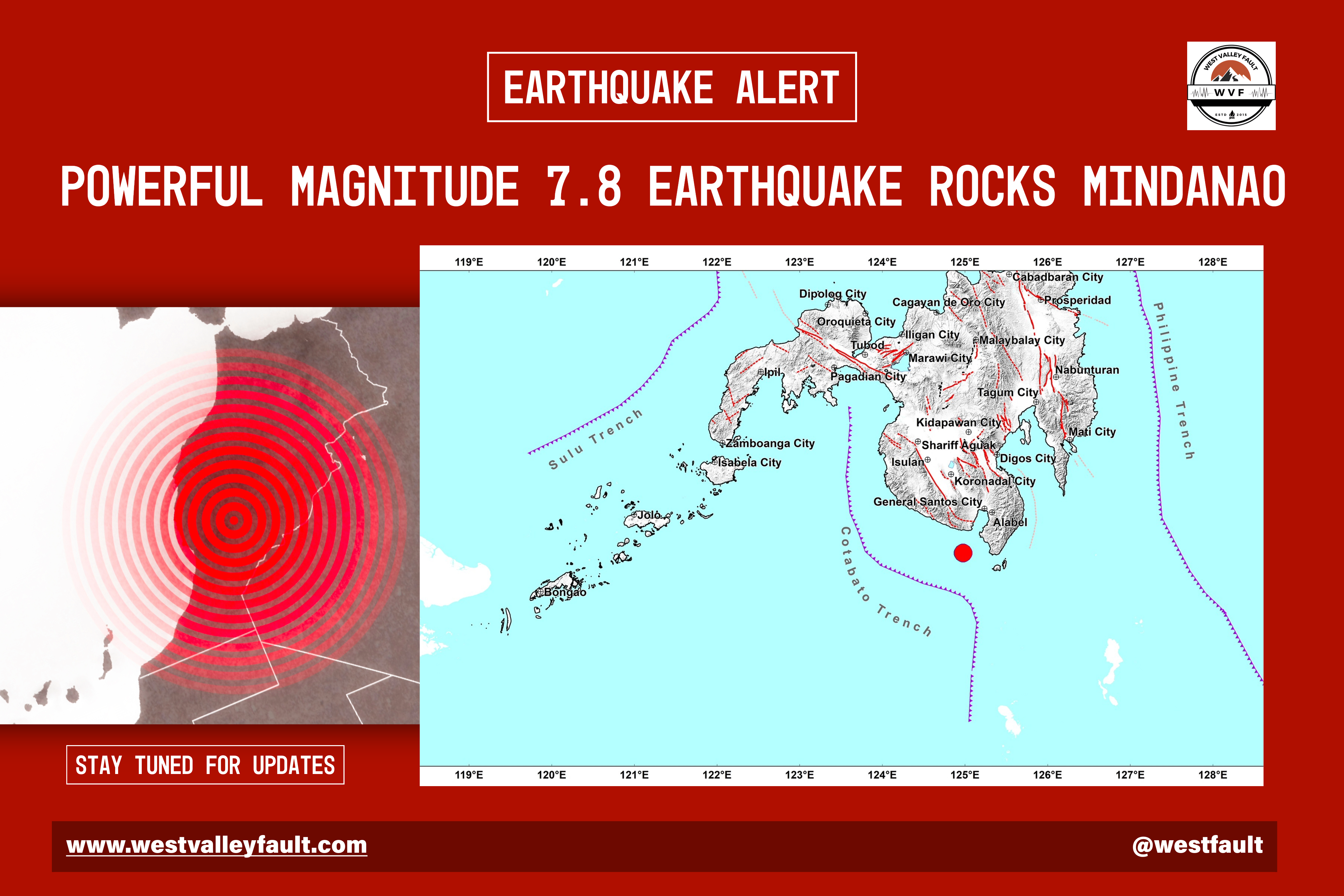
PHIVOLCS has identified unstable ground conditions in approximately 38% of the barangays in General Santos City, highlighting areas that may be more susceptible to ground failure, landslides, or structural issues during strong earthquakes and prolonged rainfall. The findings are intended to support safer land-use planning, infrastructure development, and community preparedness rather than cause unnecessary alarm.

Preparedness starts in the family. Download our free printable planner designed to help you organize the most important information your family may need during an emergency.
Remember, preparedness isn’t about expecting the worst, it’s about protecting what matters most.
FREE: ‘The Big One’ Emergency Family Planner (Download)
Key Highlights
- PHIVOLCS identified unstable ground in around 38% of General Santos City’s barangays.
- The assessment serves as a hazard reference for local governments, engineers, developers, and residents.
- Unstable ground can increase the likelihood of damage during earthquakes or heavy rainfall.
- The information supports better planning and risk reduction measures rather than evacuation or relocation.
- High-risk barangays include: Buayan, Baluan, Lagao, Bula, Katangawan, Tinagacan, Batomelong, and parts of City Heights, San Isidro and Conel.

Understanding the Issue
What is unstable ground?
Unstable ground refers to areas where the soil or underlying geological materials may be more prone to movement, settlement, or failure under certain conditions. During a strong earthquake, these conditions can amplify shaking, trigger landslides, or contribute to ground deformation.
Does this mean an area is unsafe?
Not necessarily.
Many communities worldwide are built on challenging geological conditions. The key is proper engineering design, site investigation, and compliance with building standards. Hazard maps are planning tools that help governments, engineers, and property owners make informed decisions.

This guide explores the essential items every Filipino household should have, along with practical preparedness strategies that can improve resilience and readiness for “The Big One” and other major seismic events.
Preparedness Guide
If you live or own property in General Santos City:
✓ Know your hazard information
Check whether your barangay is covered by official hazard or geohazard maps.
✓ Before building or renovating
Consider obtaining a geotechnical assessment, especially for larger structures or developments.
✓ Secure your home
Anchor heavy furniture and appliances that could fall during strong shaking.
✓ Prepare an emergency kit
Maintain supplies that can sustain your household for at least 72 hours.
✓ Review your family emergency plan
Know evacuation routes, emergency contacts, and designated meeting points.
Beyond the Headlines
The phrase “unstable ground” can sound alarming, but it should be viewed in the context of disaster risk reduction.
Hazard assessments are designed to help communities prepare and build more safely. Identifying potential risks before a disaster occurs allows local governments, engineers, and residents to make informed decisions that reduce future damage and improve resilience.
Preparedness—not panic—is the intended outcome of these studies.
Official References
- PHIVOLCS hazard and geohazard information
- Local government planning offices
- National Structural Code requirements
- Original report: Rappler


Leave a Reply